Hiking in Styria
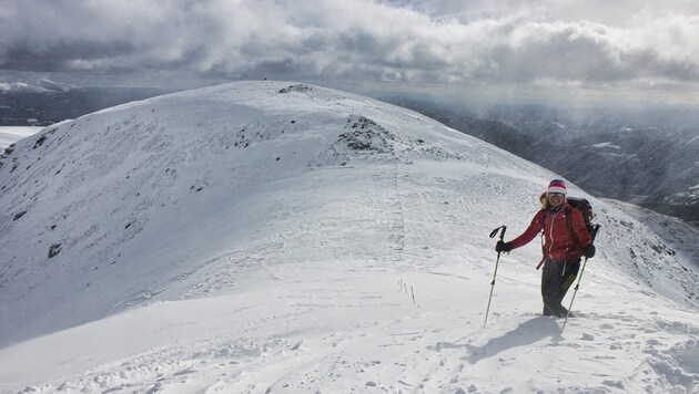
The Schießeck on the Lachtal: an inviting summit
Hiking tip: A small but beautiful summit at almost 2300 meters - close to and yet far away from the popular Lachtal ski area.
The Lachtal area is well-known and popular in both summer and winter. If you want to get to know the quieter side of the ski area, you will be delighted with this hiking tip - even though there are plenty of ski tourers out and about when the weather is fine. During the hike, we get to know a softly shaped and "large" valley at around 2000 meters and the broad mountain ridges of the Lachtal. The majority of the tour runs above the tree line, so that the view extends from the Karawanken over the Julian Alps to the first 3000 m peaks of the Eastern Alps.
Data & facts
- Hiking data: 9.3 km / 680 m / walking time approx. 4.30 h
- Requirements: Easy in good visibility, very difficult in fog or snowfall. Basically a terrain with few steep sections.
- Starting point: The ski touring parking lot is 1.2 kilometers from the ski area. We head west, past the Reifhütte and over the Lachtalbach to the designated parking lot.
- Refreshment stops: Several options in the Lachtal ski area. Can be found at: www.lachtal.at/bergerlebnisse/gastronomie
- Questions and suggestions: WEGES - Silvia and Elisabeth, 0650/2611119, weg-es.at, Facebook, Instagram and YouTube: wegesaktiv
You need good weather for this hike, as the vast landscapes are only recommended when visibility is good. Only the wind can spoil a beautiful day of snowshoeing. By the way: If you think you have already reached the summit, you should mentally prepare yourself for the fact that a short ascent to the Schießeck is the icing on the cake of the hike. And yet: an attractive mountain tour!
From the ski tourers' parking lot (1598 m), head back along the access road for a short distance and turn left uphill along a wide forest path. We follow the signposted ski route and walk up the valley first to the left and then to the right of the Lachtalbach stream until we reach the saddle with the yellow signposts, the Grillerlucke (2147 m).
From here, the signpost indicates another 30 minutes to Schießeck. We keep to the ridge and after a short time we see a large cairn on the first hill and soon afterwards our destination. A short stretch downhill and a few meters uphill to the summit cross of the Schießeck (2275 m). The way back is via the ascent route.


Kommentare
Liebe Leserin, lieber Leser,
die Kommentarfunktion steht Ihnen ab 6 Uhr wieder wie gewohnt zur Verfügung.
Mit freundlichen Grüßen
das krone.at-Team
User-Beiträge geben nicht notwendigerweise die Meinung des Betreibers/der Redaktion bzw. von Krone Multimedia (KMM) wieder. In diesem Sinne distanziert sich die Redaktion/der Betreiber von den Inhalten in diesem Diskussionsforum. KMM behält sich insbesondere vor, gegen geltendes Recht verstoßende, den guten Sitten oder der Netiquette widersprechende bzw. dem Ansehen von KMM zuwiderlaufende Beiträge zu löschen, diesbezüglichen Schadenersatz gegenüber dem betreffenden User geltend zu machen, die Nutzer-Daten zu Zwecken der Rechtsverfolgung zu verwenden und strafrechtlich relevante Beiträge zur Anzeige zu bringen (siehe auch AGB). Hier können Sie das Community-Team via unserer Melde- und Abhilfestelle kontaktieren.