Let's get going
To Lake Piburger See in Ötztal and the Weller Bridge
The storm damage on the paths has been repaired, so we hike up to the natural monument hidden above Oetz. There are pleasant passages through forests and over a well-known bridge.
At the southern end of the parking lot, we turn right towards the Ache river and walk along the bank into the valley. We soon cross the bridge and then keep left and head inwards ("Piburg See"). We walk through the meadows and into the forest. A footpath leads up into it, and our route then continues upwards as a road.
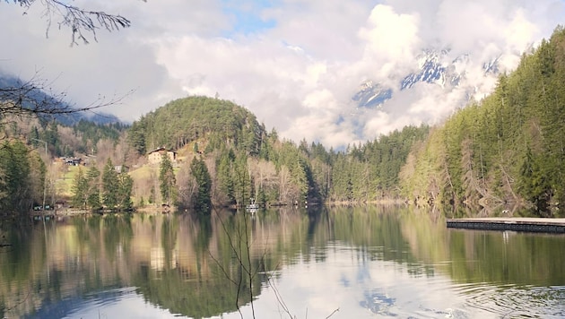
The dramatic forest damage caused by last year's storms can still be seen to the left and right. We therefore ignore the first fork to the lake and only change to the trail a little later at a bench. The route leads leisurely through the forest (not towards the "Kanzel") and finally downhill to the western shore of Lake Piburger See (913 m).
The natural monument, which lies in a basin, is up to 25 meters deep and is circumnavigated in a clockwise direction. To the west, there is the option of walking up through the meadows to the hamlet of Piburg, where you can stop for refreshments (same route back). The trail back along the north bank is always slightly up and down.
Fakten
- Valley town: Oetz (812 m)
- Starting point: parking lot in the center (approx. 780 m) directly south of the municipal office in Oetz next to the main road; staggered tariffs, only cash payment possible
- Route: road, footpath, trail
- Equipment: sturdy shoes, poles
- Requirements: basic level of fitness and stamina
- Children: from baby age
- Mountain buggy: no
- Refreshments: "Seehüter's Hotel Seerose" in the hamlet of Piburg, open up to and including April 6, closed on Tuesdays, www.seerose.at
- Public transport: public bus from Ötztal train station to the center of Oetz directly to the starting point
- Difference in altitude: around 200 m ascent and descent (entire loop)
- Length: approx. 6.5 km entire loop
- Walking time: around 2 hours for the entire loop; around ten minutes additional walking time up to the hamlet of Piburg
After circling the lake, the route goes uphill to the left of the "Seehäusl" on the road, then downhill again towards "Wellerbrücke". A path leads downhill, the Ötztaler Ache is crossed on the Weller Bridge, which has been destroyed several times by floods. It bears the name of a vacationer who financed the construction of the bridge in 1910.
Finally, we take a leisurely stroll alongside the Ache back to Oetz.


Da dieser Artikel älter als 18 Monate ist, ist zum jetzigen Zeitpunkt kein Kommentieren mehr möglich.
Wir laden Sie ein, bei einer aktuelleren themenrelevanten Story mitzudiskutieren: Themenübersicht.
Bei Fragen können Sie sich gern an das Community-Team per Mail an forum@krone.at wenden.