HIKING IN STYRIA
From Oberwölz to a lonely summit
From the historic town of Oberwölz to the panoramic Pleschaitz - an impressive spring hike
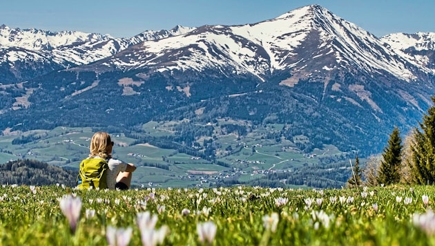
In the Murau region, between the Wölzer and Katschbach valleys, lies a forested mountain massif with a panoramic peak at almost 1800 meters - the Pleschaitz. The name comes from the Slovenian and means bald spot or bald head. This name is easy to understand, as we have a breathtaking view from the summit area on the softly shaped meadows: the view extends from the Wölzer Tauern in the north over the Schladminger, Radstädter and Hohe Tauern to the Karawanken in the south.
The 360-degree route ends with the Seetal Alps and the Seckauer, Triebener and Rottenmanner Tauern summit chain. If you want to shorten the hike - to have more time in the town of Oberwölz - you can also start on the impressive Hinterburg pass landscape. Conclusion: a lonely, wooded tour.
We start in Oberwölz (830 m) at the hiking information board opposite the parish church and follow the yellow signposts in the direction of the leisure center and Pleschaitz (939). After about 10 minutes, we cross the Wölzerbach stream and see the start of the hiking trail at the edge of the forest. It goes through the area of the high ropes course and then relatively steeply through the forest.
DATA & FACTS
- Hiking data: 16.6 km / 980 m elevation gain / walking time approx. 6 h.
- Requirements: mostly steep paths and forest roads; at Hinterburg along the asphalt road; good signposting and marking system.
- Starting point: Oberwölz town center; alternatively at the leisure center.
- Refreshment stops: several in the town of Oberwölz, none on the way.
- Questions and suggestions: WEGES - Silvia and Elisabeth, 0650/2611119, weg-es.at, Facebook, Instagram and Youtube: wegesaktiv.
We take a leisurely walk along the asphalt road to Hinterburg (1112 m), where we turn left into a side road shortly after the chapel. At the last farmstead vlg. Tragner farmstead, we continue steadily uphill along forest paths and tracks, where the gnarled old trees invite us to stop and marvel. We reach our destination, the Pleschaitz (1797 m), via panoramic meadows. The way back is via the ascent route.


Da dieser Artikel älter als 18 Monate ist, ist zum jetzigen Zeitpunkt kein Kommentieren mehr möglich.
Wir laden Sie ein, bei einer aktuelleren themenrelevanten Story mitzudiskutieren: Themenübersicht.
Bei Fragen können Sie sich gern an das Community-Team per Mail an forum@krone.at wenden.